





Executive Summary for Heavy Traffic and Road Closures in Luzon Amid Flooding
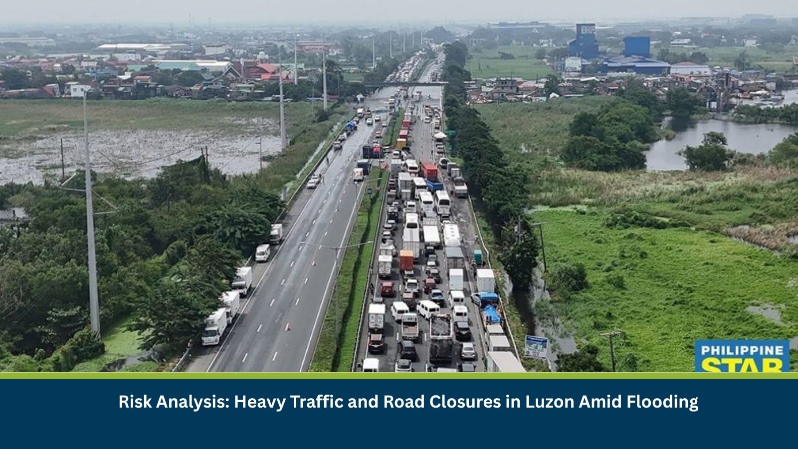
Portions of the North Luzon Expressway (NLEX) remained flooded on the morning of 2 September 2026, causing heavy traffic and prompting closures on parts of the northbound carriageway. Flooding at the San Simon Interchange in Pampanga backed up traffic along the northbound lane in Apalit, with several motorists, including truck and delivery drivers, stranded for hours near the Candaba Viaduct. The NLEX stretch beyond the Santa Rita Exit reopened shortly after 0500 hours, but the northbound entry points at Santa Rita, Balagtas and Pulilan were closed again before 0600 hours. The disruption follows a larger traffic jam that has affected both directions of NLEX since the weekend, stretching roughly 10 kilometers through the San Simon area, which the Department of Public Works and Highways attributed to heavy rainfall from the Southwest Monsoon (Habagat).
- Date of Event: 02 September 2026
- Location: NLEX corridor – San Simon, Apalit, Candaba Viaduct, Santa Rita, Balagtas and Pulilan, Pampanga and Bulacan, Philippines
- Risk Category: Natural Disasters
- Severity Score: 3/5
- Confidence Level: 75%
What is Risk Analysis in the Context of Natural Disaster Events
Natural disaster risk analysis assesses the impact of flood-related road closures and traffic disruptions on commuters, freight movement and logistics along a major expressway corridor. When key interchanges and entry points on a highway are shut or submerged, it strands travellers already on the road, forces diversions onto alternate routes, and puts pressure on delivery schedules and estimated arrival times for goods moving through the affected area.
Known Hotspots and Sensitive Areas
High Impact
- San Simon Interchange, Pampanga, the source of the flooding
- Candaba Viaduct, where motorists were stranded for hours
- Northbound entry points at Santa Rita, Balagtas and Pulilan, closed again before 6am
Medium Impact
- Tulaoc (San Simon) area, experiencing heavy southbound traffic
- Apalit roadside stopover, where motorists paused after being stuck for nearly two hours
- Maharlika Highway and Central Luzon Link Expressway (CLLEX), used as diversion routes
Low Impact
- NLEX segment beyond the Santa Rita Exit, reopened shortly after 5am
- NLEX sections outside the San Simon-Apalit-Candaba corridor
Impact on Transportation and Services
Vehicles were diverted at the Balagtas Exit and rerouted through the Maharlika Highway toward the Central Luzon Link Expressway, with the resulting traffic queue stretching toward the Candaba area. Some motorists reported being stuck for nearly an hour, and truck drivers said the prolonged congestion was affecting delivery schedules and estimated arrival times. Traffic management was applied by vehicle size, with Class 01 vehicles directed to the innermost lane while larger vehicles used the rightmost lane, where floodwaters ran deeper. Local residents took the opportunity to sell snacks and bottled water to stranded motorists along the route.
Recommended Actions
- Check NLEX advisories and traffic updates before travelling on the corridor.
- Avoid non-essential travel through the San Simon, Apalit and Candaba stretch until floodwaters recede.
- Allow extra travel time or consider alternate routes such as the Maharlika Highway or CLLEX.
- Follow updates from the Department of Public Works and Highways on floodwater levels and road status.
Emergency Contacts
- NLEX 24/7 Customer Care Hotline: 1-35000
- MMDA Metrobase Hotline: 136
- National Emergency Hotline, Philippines: 911
Final Thoughts
The recurring flooding and road closures on NLEX highlight the vulnerability of a key expressway corridor to sustained monsoon rainfall, with commuters, delivery drivers and cross-region travellers all affected. Continued monitoring of floodwater levels and entry-point status is advised as authorities work to restore normal traffic flow along the affected stretch. Leveraging MitKat’s Datasurfr enables businesses to receive real-time intelligence, monitor evolving threats and make informed decisions to protect people, assets and operations.