


Typhoon Krosa is moving towards Japan, threatening high waves, heavy rainfall, and potential disruptions across the Kanto region and Izu Islands.
What Is Happening in Japan?
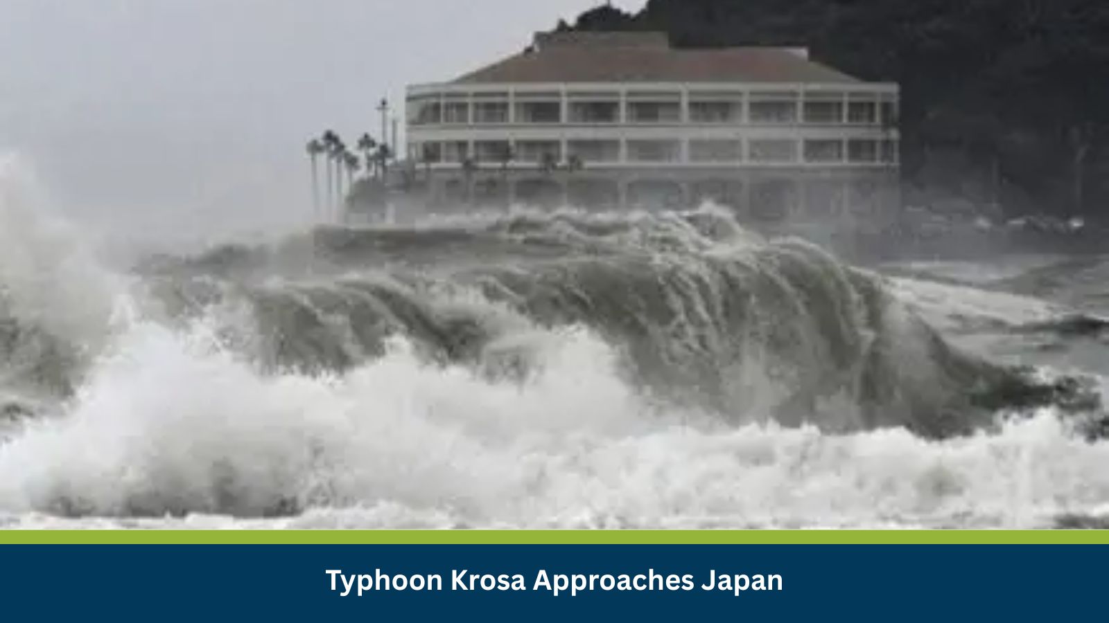
On 31 July 2025, the Japan Meteorological Agency (JMA) reported that Typhoon Krosa (Typhoon No. 09) was slowly moving north-northwest in the Pacific Ocean, south of Japan. By 9:00 AM on 1 August, the storm is expected to be 180 km east-southeast of Hachijojima Island.
At the time of the announcement, the central pressure of the typhoon was 980 hPa, with maximum wind speeds of 90 kph near the center. Wave heights are forecasted at 6 meters in the Kanto region and 7 meters in the Izu Islands, prompting officials to urge caution against high waves, strong winds, landslides, and flooding.
Why?
Japan’s typhoon season lasts from May to October, and Krosa is the latest system to threaten the eastern coast. The warm Pacific waters and seasonal monsoon dynamics are fueling this storm, while its slow movement raises the risk of prolonged heavy rainfall in affected areas.
The JMA has issued advisories highlighting potential rainfall up to 150 mm in Kanto and 200 mm in the Izu Islands between 1–2 August, increasing the risk of flash floods and coastal flooding.
Consequences Across Sectors and Communities
Transportation & Travel:
- High winds and flooding may disrupt traffic across the Boso Peninsula and coastal regions.
- Flight delays and cancellations are expected due to unsafe weather conditions.
Utilities & Infrastructure:
- Power and communication outages are likely in storm-affected regions.
- Coastal infrastructure may face damage from high waves and strong gusts.
Public Safety:
- Residents are advised to avoid low-lying areas and stay alert for landslides and storm surges.
- Authorities are implementing emergency monitoring and evacuation protocols where necessary.
Medium-Term Outlook: Preparedness and Resilience
Typhoon Krosa is likely to continue affecting the Kanto region, Izu Islands, and surrounding areas with strong winds, heavy rainfall, and high waves over the next two days. Organizations with operations or travel plans in these areas should:
- Monitor JMA updates and local advisories
- Review travel and transport plans
- Implement contingency measures for supply chains and workforce safety
Stay Ahead of Threats with datasurfr Predict
MitKat’s datasurfr delivers accurate, real-time, and contextualised data to help organisations respond swiftly to physical, environmental, and cyber threats.
With datasurfr Predict, our AI Agent not only provides context for unfolding events but also analyses vetted historical data to forecast how events are likely to evolve and their potential impact using industry and location-specific probabilistic scores.
Book a free demo today and see how datasurfr Predict can transform your risk preparedness: https://mitkatadvisory.com/why-datasurfr/