


What is Risk Analysis in the Context of Natural Disaster Events
Risk analysis for natural disasters evaluates how severe-weather hazards such as cyclones, flooding, and storm surge affect populations, infrastructure and business continuity. In Northern Australia, cyclones frequently disrupt transport, utilities and remote communities, making early assessment essential. Historical cyclone related events demonstrate patterns of rapid intensification, multi-day rainfall, and widespread utility outages. This context supports proactive planning as Cyclone Fina approaches.
Executive Summary
- Date of Event: 20 November 2025
- Location: Northern Australia, Northern Territory
- Risk Category: Natural Disasters
- Severity Score: 3 / 5
- Confidence Level: 75 %
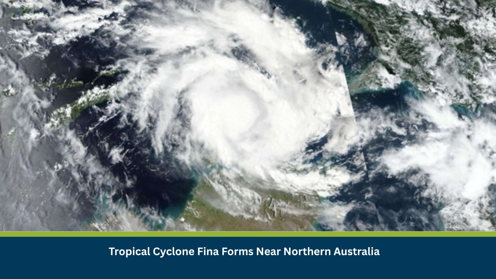
Tropical Cyclone Fina remains offshore in the Top End and Timor Sea region with BOM warnings active for coastal communities. Expected impacts within the next forty-eight to ninety-six hours include damaging winds, heavy rainfall, storm-tide risk and riverine flooding. Inland impacts may persist for up to one week as the system weakens. Critical infrastructure, remote communities and coastal towns face moderate disruption to transport, utilities, and business operations.
Known Hotspots and Sensitive Areas
High Impact: Darwin coastal zones, low-lying river catchments, Gove Peninsula and Groote Eylandt communities.
Medium Impact: Kakadu National Park floodplains, regional towns along the Arnhem and Stuart Highways.
Low Impact: Inland centres further south where impacts depend on the cyclone’s decay path.
Seasonal patterns show recurrent flooding and power disruption in Top End cyclone periods, especially November–March.
Impact on Transportation and Services
Heavy rainfall and flooding may close sections of the Stuart and Arnhem Highways, restricting access to Darwin and regional centres. Flight cancellations at Darwin International Airport are probable during peak conditions. Marine operations are restricted under active warnings. Utilities may experience outages from fallen trees, water interruption in remote communities and telecommunications degradation in isolated areas.
Recommended Actions
- Activate Incident Management Teams and circulate early warnings.
- Restrict all non-essential travel in affected regions and prepare evacuation or shelter-in-place options.
- Secure outdoor assets, elevate critical inventory and ready generators, flood barriers and emergency supplies.
- Reroute logistics away from coastal highways, prioritise essential freight and notify suppliers and clients of revised delivery windows.
- Maintain a single communication channel for hourly internal updates and issue external bulletins within two hours.
- Conduct rapid post-event assessments for restoration planning.
Multidimensional Impact
The planned public gathering in Darwin on 22 November may face disruption or cancellation due to storm conditions, affecting crowd management and transport flows. Emergency services may prioritise cyclone response, limiting capacity for concurrent events.
Emergency Contacts
- NT Emergency Services: 132 500
- Police / Fire / Ambulance: 000
- BOM Cyclone Updates: bom.gov.au
- NT Government Alerts: securent.nt.gov.au
Final Thoughts
Cyclone Fina is a moderate-severity but high-uncertainty event requiring continuous monitoring of track shifts and rainfall accumulation. Businesses should prioritise preparedness, ensure robust communication pathways and use early-warning tools such as MitKat’s Datasurfr for real-time intelligence, scenario modelling and continuity planning. Stay ahead of operational risks with real-time alerts, scenario modeling, and expert advisories with datasurfr’s Predict. Start your 14-day free trial of Datasurfr’s Risk Intelligence Platform today.