


This risk assessment covers ongoing flood and landslide disruptions across 10 major highways in Nepal as of 09 July 2025. The monsoon-induced disaster has paralyzed mobility and logistics networks, posing acute challenges for road safety, supply chain continuity, and humanitarian access. It is intended for infrastructure planners, and operational risk professionals in the Himalayan region.
Introduction
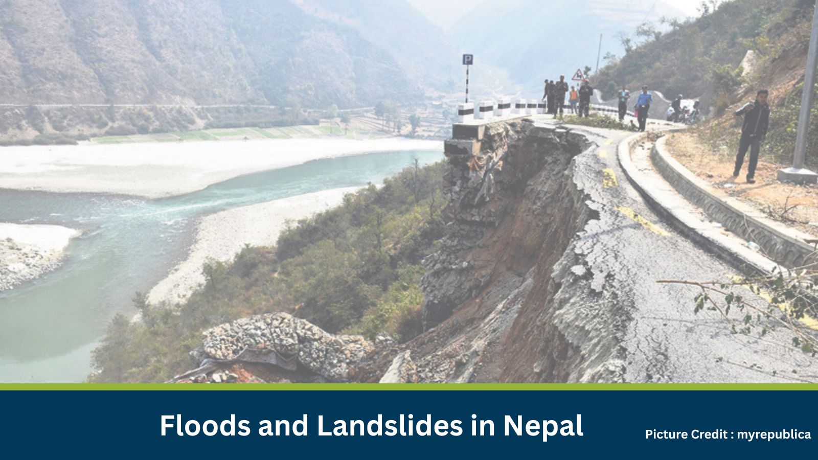
Widespread monsoon flooding and landslides have blocked 10 major highways across Nepal, isolating regions, disrupting economic activity, and posing serious risks to life and infrastructure. These incidents are seasonal and recurring during the June-September monsoon window, but this year’s impact is notably severe in scale and duration.
What is Risk Analysis in the Context of Monsoon Disasters?
Risk analysis for monsoon disasters assesses how natural hazards affect safety, access, commerce, and public services. In Nepal’s terrain, even minor rainfall can trigger landslides, while sustained rain disrupts mobility for weeks. Understanding these risks enables better planning for logistics, personnel safety, and client continuity.
Executive Summary: High Risk Level
- Date of Incident: 09 July 2025
- Location: Kathmandu and multiple highway corridors, Province No. 3, Nepal
- Risk Category: Natural Disasters
- Severity Score: 4/5
- Confidence Level: 90%
Flooding and landslides have obstructed 10 major highways, including key arteries like the Araniko and Prithvi highways. The disruptions are expected to persist for 1–4 weeks, impacting trade, transport, rescue efforts, and community access. The risk is magnified due to Nepal’s reliance on mountainous road corridors and the interconnected vulnerabilities of its infrastructure.
Known Hotspots and Sensitive Areas
- Araniko Highway (Kathmandu–Chinese border)
- Prithvi Highway along the Trishuli River corridor
- Mugling–Narayanghat section
- Sindhupalchowk, Kavrepalanchowk, and other landslide-prone districts
- Riverbank communities and remote villages are now isolated
Impact on Transportation and Services
- Road Disruption: 10 major highways blocked, isolating regions and halting inter-city trade
- Utilities: Power, water, and communications are likely disrupted in proximity to collapsed roads
- Public Safety: Elevated risk of injury, missing persons, and fatalities, especially near unstable slopes
Recommended Actions
- Monitor road clearance status via government advisories and GPS tracking.
- Pre-position critical inventory at regional hubs to bypass disrupted corridors.
- Enforce ‘no-go’ travel zones and provide staff with emergency kits and contact support.
- Issue client alerts detailing revised delivery timelines.
- Relocate vehicles and perishable cargo from flood-prone areas.
- Elevate insurance coverage for high-risk shipments.
Emergency Contacts
- Police: 100
- Fire Department: 102
- Ambulance: 101
- Nepal Police: https://www.nepalpolice.gov.np
- Department of Roads: https://dor.gov.np
- Ministry of Home Affairs: https://moha.gov.np
Final Thoughts
Floods and landslides during Nepal’s monsoon season are predictable yet devastating. The current situation demands swift mobilization of relief, rerouting of logistics, and adaptation of business continuity strategies. Organizations must act decisively to protect personnel, assets, and critical operations in the affected districts.
Stay ahead of operational risks with real-time alerts, scenario modeling, and expert advisories. Start your 14-day free trial of Datasurfr’s Risk Intelligence Platform today.
MitKat helps organisations navigate uncertain times by providing comprehensive insights about the evolving risk landscape. We offer various services including Risk consulting and Security Design, Protective Services, and cyber security services which ensure organisations become Risk Intelligent. Our AI-powered operational risk monitoring tool, datasurfr combined with expert insight enables companies to stay abreast of evolving operational risks and emerging developments.