


A strategic-level risk assessment of coastal flooding threats across Jakarta, Indonesia, valid through 13 July 2025. This analysis outlines operational impacts across transportation, business operations, and infrastructure. It supports facilities managers, business continuity professionals, and crisis response teams based in or operating through North Jakarta.
Introduction
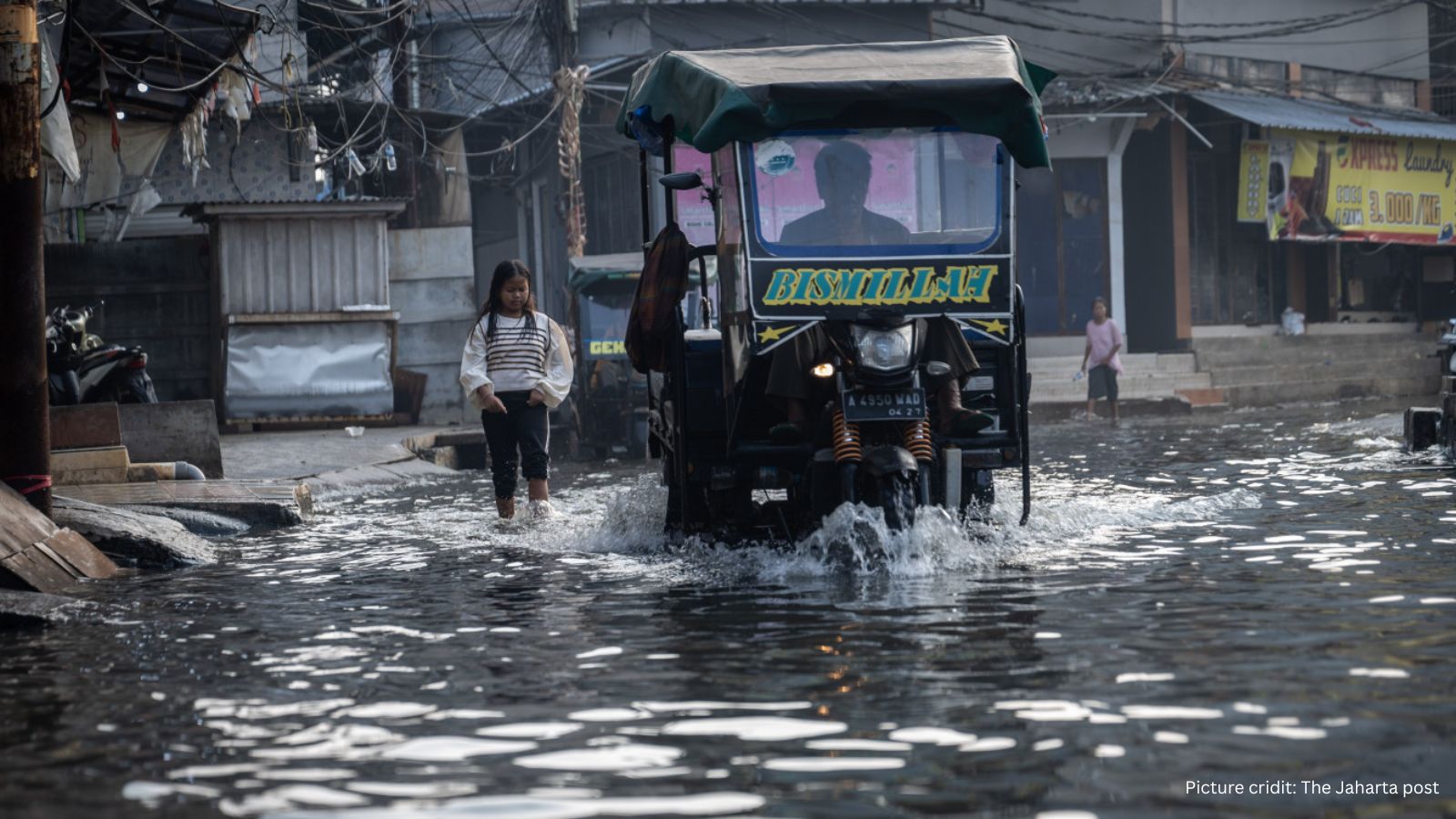
Jakarta, particularly its northern coastal districts, faces a consistent environmental threat from tidal flooding, locally referred to as ‘rob’. This warning, issued by BPBD DKI Jakarta, highlights astronomical tides and chronic land subsidence as the main drivers. Affected areas include Muara Angke, Cilincing, and Penjaringan. These conditions have historically caused disruptions to logistics, power, and mobility.
What is Risk Analysis in the Context of Coastal Flooding?
Risk analysis of coastal flooding considers how tidal surges impact daily life, transport logistics, facility operations, and infrastructure resilience. These recurring events are critical vulnerabilities for urban areas like Jakarta, where commercial zones, ports, and housing intersect with flood-prone coastlines.
Executive Summary: High Risk Level
- Date of Incident: Until 13 July 2025
- Location: North Jakarta, Indonesia
- Risk Category: Environmental Risks
- Severity Score: 4/5
- Confidence Level: 90%
Based on official alerts and pattern recognition, coastal flooding is expected to disrupt transport, business activity, and infrastructure access throughout the warning period. Particular vulnerability exists in low-lying districts and near logistical hubs. Although rarely fatal, such events incur notable financial and social costs.
Known Hotspots and Sensitive Areas
- Muara Angke, Cilincing, Penjaringan – Low-lying residential and commercial zones with recurring flood patterns.
- Tanjung Priok Port – Critical logistics hub with potential access disruptions.
- Jalan Marunda and Jalan Kalibaru – Key routes vulnerable to road closures.
Schools and clinics in North Jakarta – Risk of service suspension.
Impact on Transportation and Utilities
- Road Transport: Coastal roads may be submerged, delaying movement of people and goods.
- Public Transport: Local angkot and TransJakarta routes in affected zones may face suspension or diversion.
- Utilities: Potential damage to electricity distribution and localized power cuts, along with internet and water supply disruptions.
Recommended Actions
- Activate Facility Risk Plans: Relocate valuable ground-floor assets, test pumps, and deploy sandbags in vulnerable locations.
- Remote Work Guidance: Enable remote work for affected employees; confirm emergency contact trees.
- Adjust Logistics Strategy: Reroute deliveries away from flood-prone areas; pre-position supplies where possible.
Notify Clients and Vendors: Communicate likely delays in services or operations.
Review Infrastructure Readiness: Inspect utility systems, IT assets, and backup equipment.
Emergency Contacts
- Police: 110
- Fire Department: 113
- Ambulance: 118 or 119
- National Emergency Number: 112
- BPBD DKI Jakarta: 112 (Flood Management)
- Polda Metro Jaya (Jakarta Police): Active updates on social media
Final Thoughts
Jakarta’s recurring coastal flooding events highlight a persistent threat to operational resilience in urban coastal centers. Organizations with exposure in Jakarta must invest in preventive infrastructure, flexible logistics planning, and staff safety protocols. These measures are essential to minimize business impact and uphold duty-of-care standards. Use this warning period to validate flood response procedures and optimize mitigation resources.
Stay ahead of operational risks with real-time alerts, scenario modeling, and expert advisories.
Start your 14-day free trial of Datasurfr’s Risk Intelligence Platform today.