


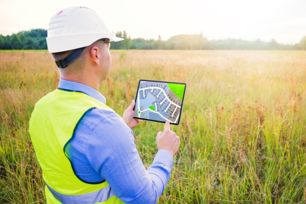
Geospatial Solutions

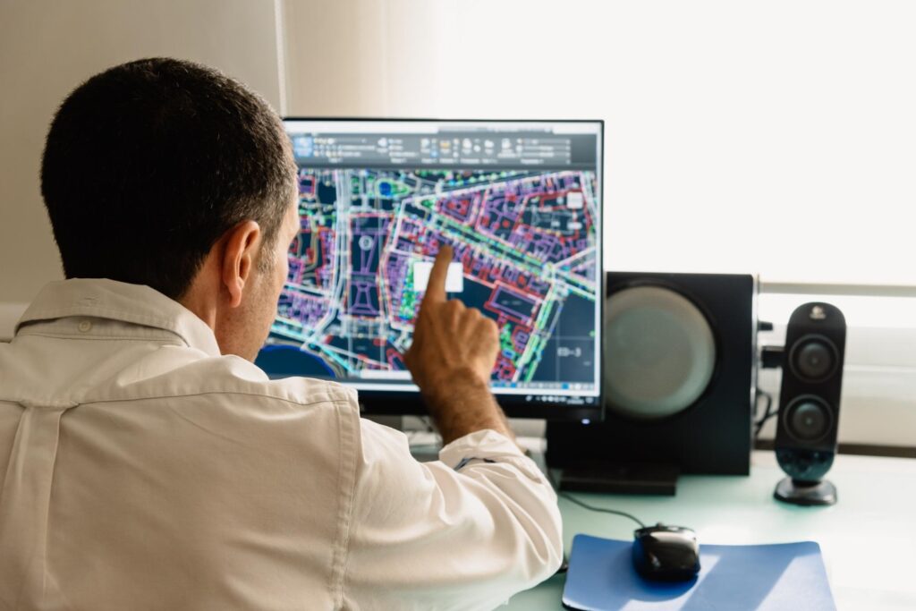
Geospatial Intelligence and Advanced GIS Mapping Solutions
Our geospatial intelligence and GIS solutions turn complex location data into clear operational decisions. We structure spatial datasets, build authoritative map layers, and design analytical workflows that answer specific business questions such as where risks concentrate, which assets are most exposed, and how service coverage can be optimized. Typical deliverables include enterprise geodatabases, interactive web maps, and decision dashboards that integrate realtime feeds and field data. The significance is precision and speed.
Teams can move from static maps to living geospatial systems that support planning, operations, and reporting. Clients gain consistent spatial standards, reduced duplication of effort, and the ability to trace every map back to a single source of truth. Our services cover data engineering, topology and quality control, spatial modeling, network analysis, routing, and multicriteria suitability. We also set up governance, roles, and metadata so platforms remain reliable as new projects and partners come online. The result is a scalable GIS capability that improves risk visibility, shortens analysis time, and enables confident decisions across portfolios and programs.

High Resolution Photogrammetry for Asset, Terrain and Infrastructure Analysis
At MitKat Advisory, we deliver high resolution photogrammetry that captures accurate, measurable reality for assets and terrain. Using calibrated cameras and flight plans, we transform overlapping imagery into Ortho mosaics, digital surface models, and detailed 3D point clouds. The significance is measurement you can trust. Engineering teams can extract dimensions, slopes, volumes, and condition indicators directly from the models, reducing site visits and accelerating design and maintenance cycles.
For customers, the value includes faster surveys, consistent quality, and integration with CAD, BIM, and GIS environments. Typical use cases are construction progress verification, stockpile volumes, corridor mapping, rightofway assessments, and incident documentation. We set control using ground checkpoints or RTK workflows for survey grade accuracy, and implement strict quality assurance, including reprojection error checks and completeness metrics. Deliverables are packaged with metadata and coordinate system details for seamless handover. By combining precision imagery with disciplined processing, we provide a dependable digital record that supports planning, compliance, and asset lifecycle decisions.

Remote Sensing and Earth Observation Analytics for Risk, Planning and Monitoring
Our remote sensing services convert satellite and aerial signals into decision ready insights. We acquire and process multispectral and radar data to map land cover, surface water, vegetation health, subsidence, urban growth, and change over time. The significance lies in scale and repeatability. Large areas can be assessed consistently, and updates can be scheduled to match planning cycles or regulatory reporting.
For clients, the value is objective evidence that supports permits, compliance, and investment decisions. We tailor indices, classification models, and alert thresholds to specific use cases such as flood mapping, drought stress, habitat condition, and encroachment detection. Workflows include atmospheric correction, cloud masking, time series analysis, and accuracy assessment against ground truth. Outputs are delivered as web services, dashboards, and georeferenced layers ready for GIS, with clear documentation of methods and confidence levels. By linking observations to KPIs and risk registers, monitoring becomes proactive rather than reactive, helping organizations target interventions, verify outcomes, and demonstrate stewardship to stakeholders.
Advanced LiDAR Surveys for Precision Terrain, Infrastructure and Urban Modeling
We provide advanced LiDAR surveys that capture the fine detail required for engineering and urban applications. Airborne, mobile, or terrestrial sensors generate dense point clouds that resolve terrain, structures, vegetation, and utilities with high accuracy. The significance is reliable elevation and feature geometry that underpins drainage design, corridor planning, clash detection, and safety assessments. For customers, the value includes shorter design cycles, fewer field conflicts, and stronger confidence in earthworks and volume estimates.
Our workflows cover flight planning, calibration, boresight alignment, and rigorous classification of ground, building, and vegetation points. We generate digital terrain and surface models, contour sets, breaklines, and 3D meshes that integrate with CAD, BIM, and GIS. Quality control includes density, completeness, and vertical accuracy checks against surveyed control. We also offer intensity analysis and canopy metrics for environmental studies. Deliverables arrive with full metadata and coordinate references so teams can implement immediately. The outcome is a dependable spatial foundation that supports cost control, risk reduction, and compliance across complex projects.
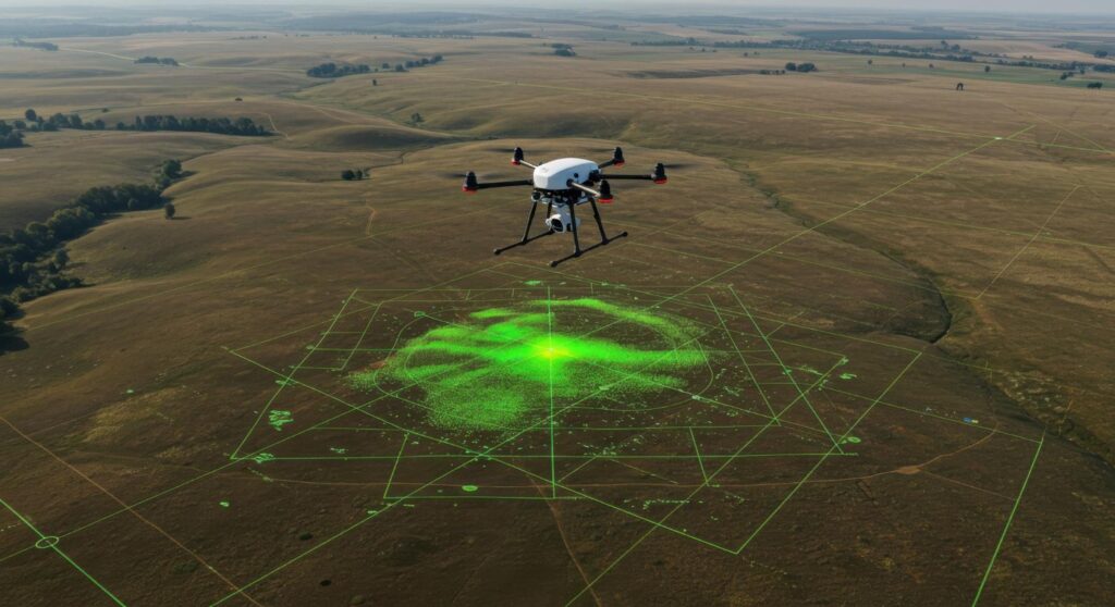
Drone and UAVBased Mapping for Rapid, HighAccuracy Spatial Intelligence
Our UAV mapping services deliver rapid, high accuracy spatial intelligence for sites where speed and access are critical. We deploy suitable platforms and sensors to capture imagery or LiDAR, then process outputs into orthomosaics, elevation models, and 3D reconstructions. The significance is flexibility and responsiveness. Sites can be surveyed safely at short notice, including hazardous or remote locations, with minimal disruption to operations. Clients benefit from frequent updates that track construction progress, detect defects, quantify stockpiles, and validate as built conditions.
We manage permissions, airspace compliance, and safety protocols, and we design flight plans that achieve required ground sampling distances and overlaps. Post processing applies rigorous photogrammetric or LiDAR workflows, with ground control or RTK for survey grade results. Deliverables are formatted for GIS, CAD, and BIM, and can feed dashboards for multi site comparison. By combining speed with repeatable accuracy, UAV mapping reduces field time, supports faster decisions, and lowers total survey cost without compromising quality
Satellite Data Processing and Analytics for LargeScale Environmental and Climate Insights
We specialize in turning raw satellite data into operational analytics that inform environmental and climate decisions at regional to national scales. Multispectral, hyperspectral, and radar imagery are processed to quantify land use change, water dynamics, crop condition, heat stress, and disaster impacts. The significance is coverage and continuity. Archives enable historical baselines, while frequent revisits support routine monitoring and rapid assessments after events.
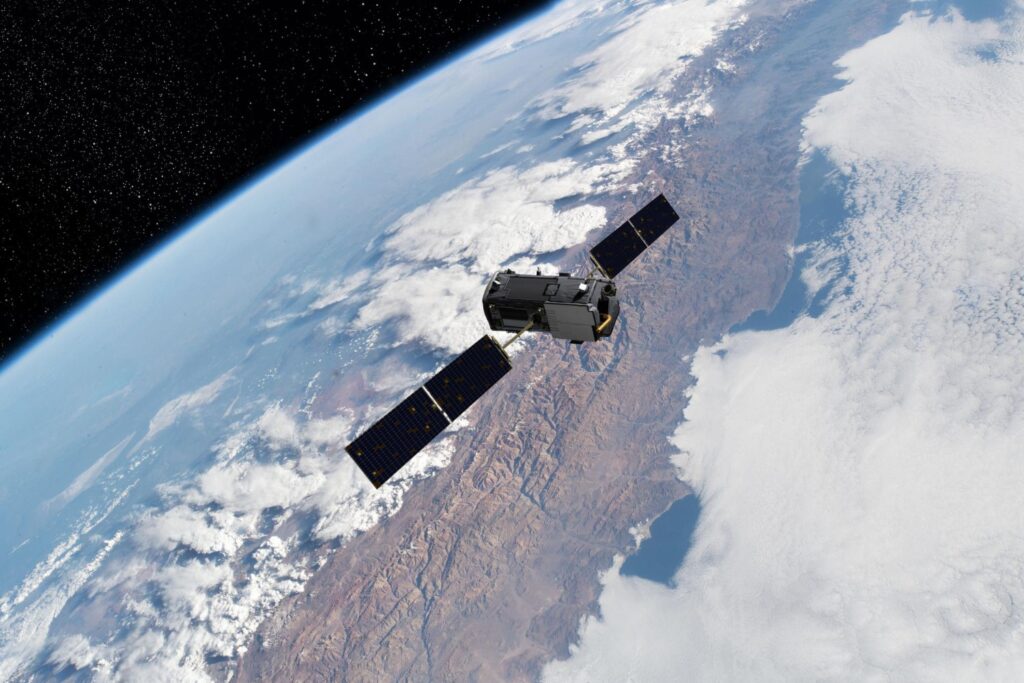
For customers, the value is defensible, transparent evidence that can be shared with regulators, investors, and communities. Our pipelines include atmospheric correction, speckle filtering for SAR, time series compositing, and machine learning classification with accuracy reporting. We deliver web map services, API feeds, and tailored dashboards that integrate with existing data systems. Where needed, we fuse satellite outputs with ground sensors and administrative data to strengthen interpretation and decision making. The result is scalable insight that supports planning, compliance, resilience, and investment prioritization, even where ground observations are limited or costly to obtain.
Digital Elevation, Surface and Terrain Modeling for Risk, Design and Resilience Planning
Our elevation modeling services provide the vertical precision required for flood studies, drainage design, route selection, and stability assessments. We create digital terrain and surface models from LiDAR, photogrammetry, or satellite stereo, then enhance them with breaklines, hydrologic enforcement, and quality checks. The significance is reliability in the third dimension. Accurate gradients and surface representation allow teams to model water flow, earthworks, and visibility with confidence.
Clients gain decision ready layers that feed hydraulic models, cut and fill calculations, slope stability analysis, and multi hazard risk screening. We tailor resolution, vertical accuracy, and file formats to the intended models and software environments, ensuring seamless integration. Deliverables include contours, hillshades, flow accumulation, and derived metrics such as curvature and roughness, alongside clear metadata and accuracy reports. By grounding projects in trustworthy elevation data, organizations reduce redesigns, avoid costly surprises, and accelerate approvals. The outcome is better engineered solutions, stronger resilience planning, and measurable reductions in project risk and lifecycle cost.