


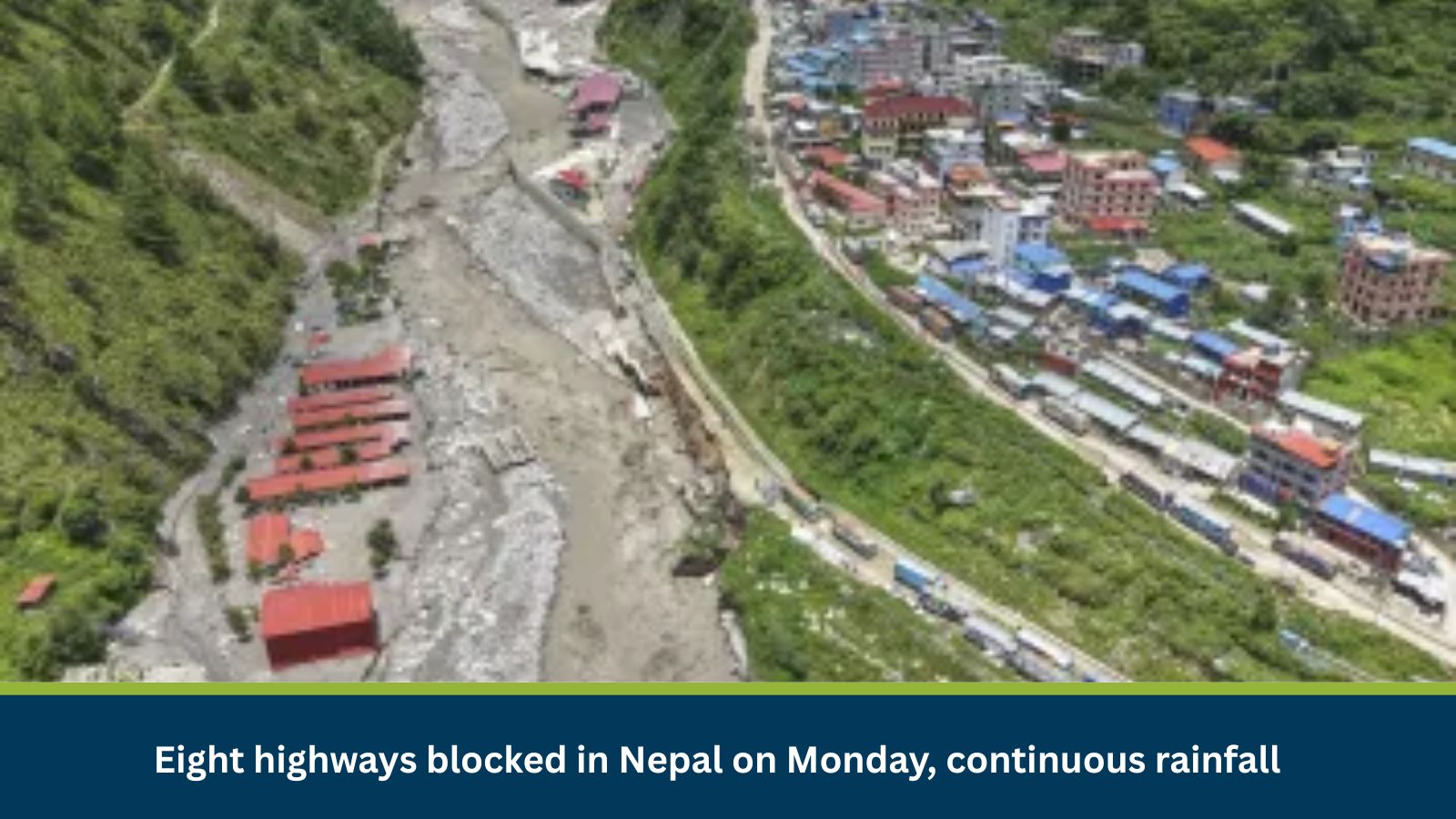
Continuous monsoon rainfall in Nepal has blocked eight highways, signaling severe travel disruptions and supply chain challenges. This annual event, due to landslides and floods, is critical to monitor for mobility, safety, and logistics, particularly in the mountainous regions.
What is Risk Analysis in the Context of Travel Risks Events?
Travel risk assessments evaluate how environmental hazards or infrastructure failures impact transportation networks and personal mobility. They are crucial for ensuring safety, maintaining logistical flows, and supporting business continuity. The current blocking of eight highways in Nepal due to continuous rainfall is characteristic of the annual monsoon season (June-September). Historical data consistently shows that heavy rainfall leads to predictable landslides and widespread road blockages across Nepal’s hilly and mountainous regions.
Executive Summary
- Date of Incident: 28 July 2025
- Location: Kathmandu, Nepal
- Risk Category: Travel Risks
- Severity Score: 4/5
- Confidence Level: 90%
Monsoon season in Nepal consistently brings heavy rainfall, leading to predictable landslides and widespread road blockages. The current incident of eight blocked highways on 28 July is characteristic of this annual pattern. Based on past events, disruptions are likely to persist intermittently over the next three to four weeks, peaking during intense rainfall. While minor blockages may clear within 24-72 hours, significant damage could lead to closures lasting one to four weeks, severely impacting regional connectivity. The challenging mountainous topography exacerbates the severity, as alternative routes are often scarce, amplifying economic and social impacts. This assessment forecasts ongoing mobility challenges and supply chain disruptions.
Known Hotspots and Sensitive Areas
Sensitive areas include critical sections of the BP Highway traversing through mountainous terrain in Sindhuli and Udayapur districts, the Kanti Highway corridor connecting Kathmandu Valley to the Terai, and the Mugling-Narayanghat stretch in Chitwan, known for high landslide susceptibility. Additionally, river valleys and areas adjacent to major river systems are prone to flash floods.
Impact on Transportation and Services
- Road Closures: Eight major highways, including sections of the BP Highway, Kanti Highway, and the Prithvi Highway, are subject to intermittent or prolonged closures due to landslides and waterlogging.
- Transport Disruption: Widespread road closures severely disrupt inter-district public and commercial transport, including passenger buses and freight carriers. This leads to extended travel times, diversions, isolation of communities, and increased reliance on limited air transport options. Essential goods movement is significantly delayed, impacting supply chains nationally.
- Utility Damage: Landslides and flash floods frequently damage essential utilities located alongside blocked highways, including power transmission lines, water pipelines, and fiber optic cables, causing localized outages.
- Business Operations: Road blockages impede workforce movement, disrupt access to markets, and cause delays in raw material and finished goods transport, leading to operational inefficiencies and potential losses for local businesses.
Recommended Actions
- Dynamic Logistics and Supply Chain Rerouting: Immediately identify and utilize pre-vetted alternative transportation routes for critical inbound materials and outbound deliveries. Assess real-time road conditions to implement contingency plans.
- Flexible Work Arrangements and Employee Safety: For non-essential personnel, activate remote work capabilities. For essential staff, coordinate safe transportation or temporary accommodations, prioritizing safe routes.
- Asset Security and Facility Integrity: Conduct rapid assessments of facilities and assets near affected highways. Secure vulnerable equipment, move critical assets to higher ground, and reinforce site security.
- Proactive Customer and Stakeholder Communication: Develop and disseminate clear, concise, and timely updates to clients, suppliers, and partners regarding potential service delays or operational adjustments.
Emergency Contacts
- Police: 100
- Fire Department: 101
- Ambulance: 102, 108
- National Emergency: N/A
Official Government Websites:
- Ministry of Home Affairs, Nepal: https://moha.gov.np/
- Department of Roads, Nepal: https://dor.gov.np/home
- National Disaster Risk Reduction and Management Authority (NDRRMA), Nepal: https://ndrrma.gov.np/np
Final Thoughts
The baseline scenario anticipates continuous rainfall with intermittent blockages and delays. A moderate escalation could bring intensified rainfall, causing prolonged closures and initial infrastructure damage. A severe escalation risks catastrophic rainfall, widespread large-scale landslides, and significant damage to critical infrastructure, potentially leading to isolated districts and a humanitarian crisis. Businesses must prioritize personnel safety, secure assets, and maintain agile supply chain strategies. Investing in early warning systems and preparedness tools is crucial for resilience in Nepal’s challenging monsoon environment.
Stay ahead of operational risks with real-time alerts, scenario modeling, and expert advisories with datasurfr’s Predict.
MitKat helps organisations navigate uncertain times by providing comprehensive insights about the evolving risk landscape. We offer various services including Risk consulting and Security Design, Protective Services, and cyber security services which ensure organisations become Risk Intelligent. Our AI-powered operational risk monitoring tool, datasurfr combined with expert insight enables companies to stay abreast of evolving operational risks and emerging developments.