


What is Risk Analysis in the Context of Natural Disaster Events
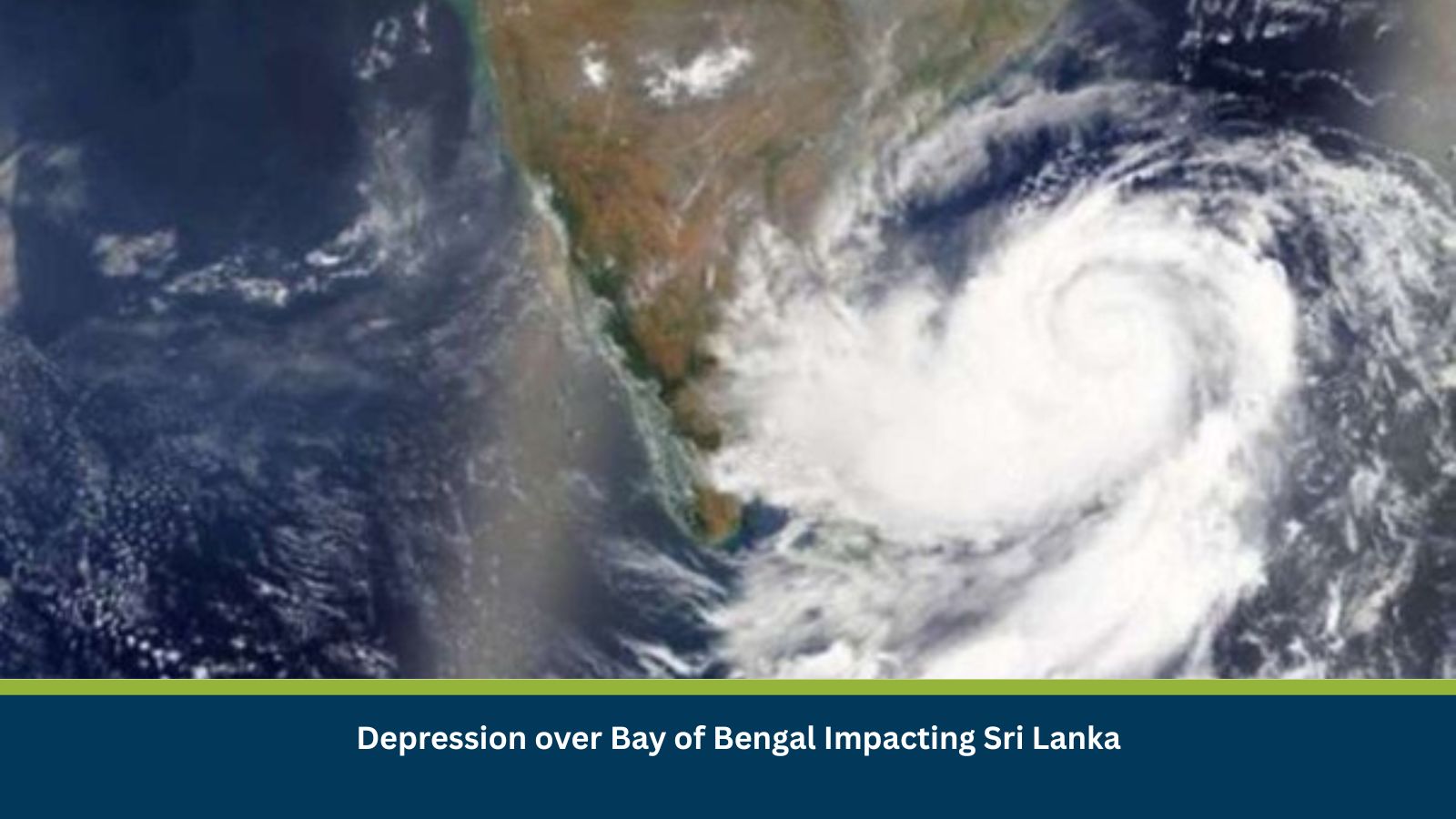
Natural disaster risk analysis evaluates hazards arising from environmental and meteorological phenomena such as cyclones, depressions and extreme rainfall. In this context, a Bay of Bengal depression presents a rainfall-driven hazard relevant to Sri Lanka’s flood- and landslide-prone geography. Historically, similar January depressions have caused localized but impactful flooding and slope failures, particularly in central highlands and eastern districts.
Executive Summary
- Date of Event: 08 January
- Location: Sri Lanka; Bay of Bengal
- Risk Category: Natural Disasters
- Severity Score: 3 / 5
- Confidence Level: 70 %
A low-pressure depression over the central Bay of Bengal is forecast to persist near Sri Lanka for two to four days. The system is expected to generate heavy rainfall, localized flooding, landslides in hill districts and rough coastal conditions. Impacts are assessed as moderate, with heightened risk during the first 48–72 hours.
Current Updates
Meteorological advisories issued on 08 January indicate enhanced convection and heavy showers across eastern, southern and central Sri Lanka. Forecasts highlight localized rainfall exceeding 100 mm within 24 hours in parts of Eastern Province, Uva and Sabaragamuwa. Sea conditions along the coast are expected to remain rough, with strong onshore winds and elevated wave heights.
Known Hotspots and Sensitive Areas
High Impact: Badulla, Nuwara Eliya and Ratnapura districts due to landslide susceptibility; low-lying coastal areas of Eastern Province for flooding and surge.
Medium Impact: Colombo and Western Province floodplains, including the Kelani River basin, where urban drainage is stressed during intense rainfall.
Low Impact: Northern coastal districts such as Jaffna, where rainfall impacts are expected to be less severe.
Recurrent patterns show hill-country landslides and coastal flooding during similar depressions, particularly when rainfall persists beyond 48 hours.
Impact on Transportation and Services
Road transport faces disruption from flooding and debris, particularly along the A4 (Colombo–Badulla), A5 near Welimada and sections of the A2 coastal highway. Rail services on the Kandy–Badulla and Colombo–Matara lines may be suspended temporarily. Nearshore fishing and ferry operations are likely to be halted due to high seas, affecting coastal logistics and livelihoods. Utilities may experience localized power and water interruptions in flood-prone areas.
Recommended Actions
- Organizations should activate crisis management protocols, prioritize employee safety in flood- and landslide-prone districts and enable remote work where feasible.
- Assets and critical equipment should be elevated or secured, and non-essential outdoor operations suspended.
- Businesses should reroute supply chains away from vulnerable hill and coastal corridors and maintain close coordination with meteorological authorities and the National Building Research Organisation for advisories.
Multidimensional Impact
No concurrent non-related incidents have been identified. However, prolonged rainfall may strain local emergency response capacity and relief resources if escalation occurs.
Emergency Contacts
- Emergency Services (Police/Fire/Ambulance): 119/110
- Disaster Management Centre (DMC): dmc.gov.lk/
- Meteorological Department: meteo.gov.lk/
Final Thoughts
The risk trajectory suggests a moderate but manageable natural disaster event with the highest impacts likely within the next three days. Businesses and authorities should monitor rainfall intensity, landslide advisories and transport conditions closely. Early-warning intelligence and preparedness platforms such as MitKat’s Datasurfr remain critical for timely decision-making and operational resilience. Stay ahead of operational risks with real-time alerts, scenario modeling, and expert advisories with datasurfr’s Predict. Start your 14-day free trial of Datasurfr’s Risk Intelligence Platform today.
… [Trackback]
[…] Find More on on that Topic: mitkatadvisory.com/depression-over-bay-of-bengal-impacting-sri-lanka/ […]
… [Trackback]
[…] Find More on on that Topic: mitkatadvisory.com/depression-over-bay-of-bengal-impacting-sri-lanka/ […]
… [Trackback]
[…] Find More Information here on that Topic: mitkatadvisory.com/depression-over-bay-of-bengal-impacting-sri-lanka/ […]