


Overview
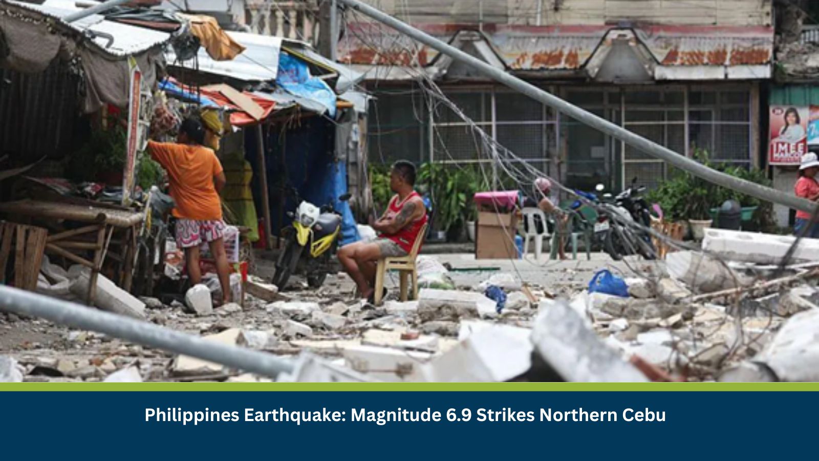
A Philippines earthquake measuring magnitude 6.9 struck offshore near Bogo City, northern Cebu Province, on 30 September 2025. The tremor was strongly felt across Metro Cebu, as well as parts of the Central and Eastern Visayas, including Leyte and Biliran. The earthquake, located in the seismically active Pacific Ring of Fire, caused widespread destruction and highlighted the vulnerability of the region to natural disasters.
At least 69 fatalities and 150 injuries have been confirmed by national and international agencies. Multiple aftershocks, some exceeding magnitude 5, have been recorded, further straining rescue and recovery efforts.
Background
The Philippines sits on the Pacific Ring of Fire, one of the world’s most earthquake-prone zones. This region regularly experiences seismic activity due to tectonic plate interactions. The earthquake struck amid ongoing recovery efforts from recent typhoon-related damage, compounding the impact on local communities.
Although no official tsunami warning was issued, advisories were released for coastal areas due to sea level disturbances and reports of unusual wave activity. Local authorities remain cautious about potential secondary hazards such as landslides and soil liquefaction in already weakened areas.
Immediate Implications
Infrastructure and Services
The Philippines earthquake caused collapsed residential and public buildings, significant road and bridge damage, and widespread power and communication outages. Northern Cebu and nearby islands were among the hardest hit. Restoration of electricity, water, and telecommunications could take days to weeks, especially in remote areas.
Rescue and Relief
Rescue operations are ongoing but have been hampered by aftershocks, damaged access routes, and strained emergency services. Local governments, along with the Cebu provincial government, declared states of calamity, triggering emergency funding and mobilization. Requests have been issued for medical volunteers and critical supplies.
Coastal Precautions
The Philippine Institute of Volcanology and Seismology (PHIVOLCS) has issued advisories for coastal communities in Cebu, Leyte, and Biliran, warning of potential sea-level anomalies and urging caution near shorelines.
Outlook
In the coming days, aftershocks may continue, risking further structural collapses, particularly in buildings already weakened by previous storms. Authorities may enforce road closures and movement restrictions to conduct structural assessments and reduce risks from landslides or liquefaction.
Economic activity in northern Cebu is expected to slow due to transport and logistics disruptions, impacting supply chains and emergency distribution. Relief operations will likely remain the government’s focus for weeks.
For businesses and organizations, it is critical to monitor official updates from PHIVOLCS, the National Disaster Risk Reduction and Management Council (NDRRMC), and local government units. Contingency plans should include employee safety protocols, supply chain adjustments, and communication resilience in anticipation of prolonged disruptions.
Conclusion
The Philippines earthquake of 30 September underscores the country’s exposure to seismic hazards and the cascading impact such disasters can have on infrastructure, supply chains, and communities. With fatalities mounting and infrastructure heavily damaged, the priority remains on rescue, relief, and stabilization. Preparedness and resilience planning will be crucial in the days and weeks ahead.
Stay Ahead of Threats with Datasurfr Predict
MitKat’s datasurfr delivers accurate, real-time, and contextualised data to help organisations respond swiftly to physical, environmental, and cyber threats.
With Sam AI, our AI Agent not only provides context for unfolding events but also analyses vetted historical data to forecast how events are likely to evolve and their potential impact using industry and location-specific probabilistic scores. Book a free demo today and see how datasurfr Predict can transform your risk preparedness.